Our Itinerary in the Rockies

Our Itinerary in the Rockies

Summit County

Summit County
Dillon Reservoir

Getting to and from the West

Getting to and from the West

Friday, September 29, 2017

Friday, 9/29/17

This is our last day camping in the West and we spent it in the Badlands! 


a pronghorn 

 one of the 120 bighorn in the Badlands


 pronghorn sheep


 a prairie dog town

 those are buffalo, not seals


This is our last day camping and we spent it in the Badlands! 

After a simple breakfast of cereal and coffee we returned to the Visitors’ Center and watched a movie about the area which emphasized the difficulty of both surviving and making a living in this area that was once entirely part of the Lakota Nation.  We then drove to the “Door” & “Window” trailheads where we took short hikes 
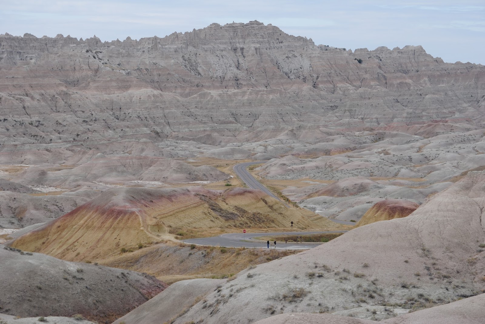
into the Badlands.  From there we drove across the park, stopping at numerous pullovers to enjoy the landscape and wildlife.  Even in this barren wasteland we saw some beautiful fall foliage!

We also saw prairie dogs by the thousand, a small group of pronghorn sheep, some bighorn sheep, and finally after a 6+ mile drive down a gravel road, the iconic buffalo.  A whole herd of them!

With our wildlife fix satisfied, we stopped in Wall, the home of the classic tourist trap, Wall Drug, who have hundreds of billboards throughtout the Dakotas; very similar to I-95’s “South of the Border.  After a quick walk through of the mall like Wall Drug, which sells everything from Western Wear to fudge, we had an enjoyable lunch at the Badlands Saloon, and then headed back toward the eastern end of the national park. 

Before re-entering the park, we stopped at the nearby “Minuteman Missile National Historical Site” which is a museum to the Cold War and numerous Minuteman Missile launch control facilities that located in this area, North Dakota, Wyoming, and Montana.  It was fascinating and creepy; especially with Trump and Kim Jong-un playing their daily game of chicken.  I left the following message in the visitors log, “…if Trump calls, don’t answer!”

All in all, today was a relaxing one.  We only recorded 78 miles on our odometer, and we were back at our campsite by 4 pm.

Tomorrow we start our trip home with stops in Madison, Wisconsin, West Bloomfield, Michigan; to visit my sister, Wendy; and Massena, New York; to visit Joni’s Aunt Roey. 

This will be my last blog entry for this incredible trip.  My father always talked about taking such a trip, but he never made it.  He would have loved it. 

Joni and I have indeed been fortunate to visit so much of our beautiful country.  Words, photographs and videos don’t do it justice.  As much as the thrill of seeing so many of our country’s natural resources, we have equally enjoyed the people that we have met along the way.  Travellers seem to be more willing to talk to each other as we explore our country’s treasures. 


Can’t wait to start planning our next trip!

Thursday, 9/28/19


 The hole in the center of this picture is the original entrance to these caves!


 box work cave ceiling


 Like a horse, when a buffalo raises its tail, its about to...


 Up early today, hoping to see wildlife in Wind Cave National Park, but only saw the same three deer, a doe and her fawns, that we saw last night.  I took a short hike over the hill that overlooked our campsite and enjoyed the rolling grasslands that dominate this park.  After breakfast we packed up and headed to the visitor center to book a tour of the wind cave.  We were able to catch the first tour of the day, a 75 minute tour that descended more than 400 feet into North America’s most extensive cave system.  It was only 54° in the caves so we dressed in down to stay comfortable.

These caves do not contain the water that most familiar ones like Carlsbad or Meramec Caverns do; no stalagtites or stalagmites.  Instead these caverns have formations called boxwork, which is lattice-like but as fragile as potato chips. It was very pretty but  not easy to photograph.

Once we finished drove through Wind Cave NP, enjoying the prairie dogs and buffalo, through Custer State Park which seemed like an extension of Wind Cave, and onto Mount Rushmore, which is only about 40 miles form Wind Cave NP.

Driving through Custer State Park we wondered if there is the same controversy around naming towns and parks after Custer as the South is experiencing with towns and parks and monuments that honor Robert E. Lee.

The monument is located in the town of Keystone, which we drove through before getting to the monument.  The town was incredibly tacky, filled with every kind of souvenir and novelty shop you can imagine.  It made Lake George, Long Lake, or Alex Bay, New York, look like Aspen!

The monument was awesome and well worth the trip.  The road to the monument is uphill and winding.  You don’t see the monument until you’re right on top of it and then BAM, there it is…four of our greatest presidents, and there’s room for Trump too.  We had lunch, a hamburger for Joni and a bison burger for me, at the cafeteria right below the monument,  and we were lucky to get a front row table on the outside terrace, so we just saw and enjoyed the sculpture for quite a while.  The National Park Service again proved its value in preserving our wonderful national resources; everything was very well done.


Leaving Rushmore we drove through Custer State Park which was filled with buffalo, through Rapid City, onto the Badlands National Park which was less than 100 miles away.  We arrived around 4 pm and were immediately struck by this park’s unique qualities.  The visitor center was still open, so we toured that facility and then headed to our campsite which was barren, like the Badlands, but has incredible views.  Bacon & eggs for dinner, and we closed the day enjoying the stars under these incredible big skies!

Wednesday 9/27/17

Main Street, Frisco


We got in one final hug with Alex this morning as he left for work.  After leaving Alex’s home around 7:45 AM, we drove to Frisco, did the laundry, had breakfast at the Butterhorn Baker, again, bought some groceries, and filled up our water jugs.

As we headed east toward the Eisenhower/Johnson Tunnel we were treated to a view of a fresh snowfall from last night on the higher peaks.  Traffic was relatively light as we made our way through Denver and after about two hours we stopped at to pick up sandwiches at the Choice City Deli in Fort Collins, a favorite of Alice’s from her days at CSU.  If you’ve never been to Fort Collins, put it on your list; it’s one of Colorado’s finest!

 Leaving Fort Collins the rest of our trip through Wyoming, and into South Dakota was uneventful.  The roads were straight, and very few cars or trucks.  The speed limit in Wyoming on I-25 is 80 mph! The scenery is very similar to western Kansas; rolling prairies.  We did have to keep our eyes open for deer; they were everywhere, sometimes in herds of 20+.


We arrived at our campsite at Wind Cave National Park in Custer, South Dakota at 6:50 PM.  We travelled 454 miles in about nine hours.  As we drove into the park, we were treated to views of grazing buffalo and deer.  Thrilling, but wanting to set up camp before dark, I didn’t take any pictures; that will have to wait ‘til tomorrow. 

Tuesday, September 26, 2017

Tuesday, 9/26/17

We took the scenic route from Moab to Silverthorne today, a drive that covered about 410 miles and took us 9 hours.  The scenery was terrific as we drove along the Delores River canyons toward Grand Junction.  We visited our last National Monument in Colorado just outside Fruita, and took the 23 mile Ramrod Drive which provided us with our first unclose shots of some mule deer.  We didn't get to Silverthorne until 9 PM, had some pizza with Alice & Alex, took our first showers in five days, and hit the hay.  It was 41 degrees when we got into our van for the night.   


Monday, 9/25/17


Here are a few of the scary turns we had to take each day to get to our campsite in Kane's Canyon. 


We spent today in Arches National Park, and it was amazing.  There was a 30 minutes to get into the park, which was surprising to me since it was Monday, so we opted to skip the visitor center and drive directly to the trailhead for Delicate Arch.  Our hike, about two miles to the arch, was longer but easier than our hike yesterday to Upheaval Dome.  It was a 2 mile hike but you don’t see the Delicate Arch until the last second of your hike.  The final 400 yards was along a narrow ledge that overlooks a steep drop.   I was nervous, but when you get to the end of the ledge, BAM, there’s Delicate Arch.  It’s overwhelming.

We spent about an hour sitting at the arch, enjoying its awesome beauty, and also people watching too. 

Our hike back to the trailhead was mostly downhill, so it was easy.  We then drove to several other scenic overlooks in the park before heading back to Moab for an early dinner at “Twisted Sister”.   Our meal was fabulous! 

We were back at our campsite by 7:00 PM, so we had no difficultly navigating the treacherous canyon turns, and then we ended the night with a campfire under the moonlit skies and s’mores!  What a day!